About Me

Hello! I'm TJ.

I completed my Ph.D. with Prof. Cynthia Gerlein-Safdi at UC Berkeley (2024).

Currently a Postdoctoral Researcher with Prof. Gabriele Villarini at Princeton University.

I work at the intersection of nature and computer vision, bridging physical understanding and data-driven intelligence.

My research integrates remote sensing, physics-based modeling, and machine learning to quantify climate hazards and translate complex environmental processes into decision-relevant insights.

I focus on high-impact hazards including extreme flooding, wildfires, and hailstorms, and I develop scalable algorithms and tools at global and large-regional scales to accelerate the translation of scientific discovery into real-world applications.

Outside of research, I find my rhythm in rap, dance and vibe coding.

Tianjiao Pu

Education

Ph.D. University of California, Berkeley Civil and Environmental Engineering 2024
M.Sc. University of California, Berkeley Civil and Environmental Engineering 2019
B.Sc. University of Illinois Urbana-Champaign Civil and Environmental Engineering 2018

I was born and raised in Wuxi, China, on the shores of Tai Lake (a critical freshwater lake in the Yangtze River Delta), with the Grand Canal (the world’s longest ancient artificial waterway) running through the city — both inspired my pursuit of environmental engineering.

My technical foundation is shaped by a Minor in Computer Science from UIUC and by Minor Fields in Earth and Planetary Science and Computer Science during my Ph.D. at Berkeley, providing the analytical tools to decode complex natural processes through a computational lens.

Selected Projects
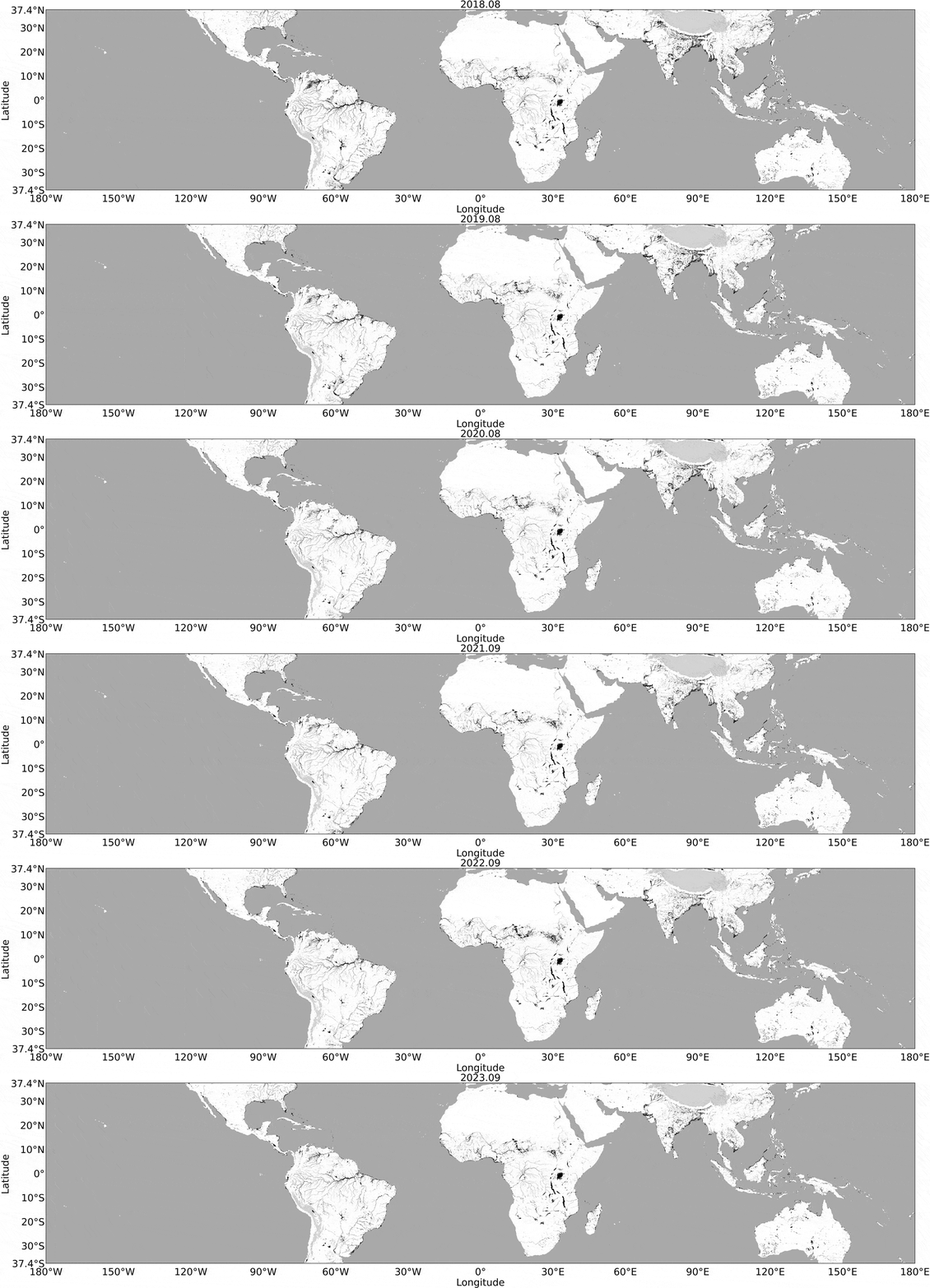
Wetland Dynamics

Berkeley-RWAWC:Wetland Dynamics Mapping via CV

Developed computer vision framework for tropical and subtropical surface water mapping with CYGNSS, overcame the limitations of traditional optical remote sensing under persistent cloud cover. Delivered the first official water mask product to the CYGNSS Science Team. The dataset is hosted at NASA PO.DAAC .

Featured in: UC Berkeley News, Berkeley Engineer magazine, NASA PO.DAAC

Computer Vision Random Walk GNSS-R Hydrology Remote Sensing

Academic Engagement

Selected Presentations

Note: Oral unless specified. Presented by collaborator*
2025 AGU FallNew Orleans, LA
Daily CYGNSS Water Maps Reveal Inland Water Hot Spots and Hot Moments, from Wetlands to Floodplains Invited
Meter-Scale Hail Detection from Space Poster
High-Resolution Flood Inundation Mapping of U.S. Tribal Nations Under Current and Future Conditions: The Case of the Santee Sioux Nation Poster American Geophysical Union Fall Meeting
2025 MAMI WATARome, Italy and Online
Daily CYGNSS WaterMask Reveals Hydrologic Hot Moments and Dynamic Wetland Variability IEEE GRSS Workshop at Sapienza University of Rome
2025 CYGNSS STMMiami, FL
Mission Status and Ocean Wind Data Products - Water Mask Product Update CYGNSS Science Team Meeting
2024 AGU FallWashington, D.C.
Deciphering the Interplay Between Fire Regimes and Wetland Refill Dynamics in the Pantanal: Implications of Climate Variability and Fire Behavior Poster American Geophysical Union Fall Meeting
2024 WaterSciConSt. Paul, MN
Evaluating the Interplay Between Wildfires and Wetland Resilience Through GNSS-R-derived Inundation Monitoring in Tropical Ecosystems Poster The Water Science Conference
2024 CYGNSS STMAnn Arbor, MI
The Berkeley-RWAWC Watermask Product and Ongoing Efforts Towards a CYGNSS-Based Flood Warning System* CYGNSS Science Team Meeting
2024 AGU Chapman Honolulu, HI
From Flames to Floods: A CYGNSS-Based Study Assessing the Interplay Between Wildfires and Wetland Resilience in the Tropics Poster
Beneath the sea of clouds: a new CYGNSS-based monthly watermask product uncovers the hidden seasonality of tropical waterbodies* Poster American Geophysical Union Chapman Conference - Remote Sensing of the Water Cycle: Sensors to Science to Society
View Earlier Presentations (2019–2023)
2023 AGU FallSan Francisco, CA
Unprecedented Wildfires and Wetland Resilience: A Remote Sensing-based Analysis of the Dynamic Interplay Between Changing Fire Behavior and Wetland Refill Pattern in the Pantanal
Beneath the sea of clouds: a new CYGNSS-based monthly watermask product uncovers the hidden seasonality of tropical waterbodies* American Geophysical Union Fall Meeting
2023 MAMI WATAPasadena, CA
Revolutionizing tropical wetland monitoring with GNSS-R: Introducing Berkeley-RWAWC, UC Berkeley's Random Walk Algorithm WaterMask from CYGNSS IEEE GRSS MAMI WATA Workshop at Caltech
2023 IGARSSPasadena, CA
Mapping Urban Flooding with CYGNSS and Computer Vision: A Florida Case Study
Coupling CYGNSS and DEM Data For High Spatio-Temporal Mapping of Inundation* IEEE International Geoscience and Remote Sensing Symposium
2023 IEEE GNSS+RBoulder, CO
Integrating CYGNSS and DEM Data with Computer Vision Algorithm, RawIF-based Validation for High Spatio-temporal Mapping of Inundation IEEE GNSS+R Specialist Meeting on Reflectometry using GNSS and other Signals of Opportunity
2023 CYGNSS STMOnline
Continental-Scale Mapping of Waterbodies Using Raw IF Tracks for Validation: An Update CYGNSS Science Team Meeting
2022 AGU FallChicago, IL
Coupling CYGNSS and Digital Elevation Data for High Spatio-temporal Mapping of Inundation American Geophysical Union Fall Meeting
2022 CYGNSS STMAnn Arbor, MI
Water Masks for Modeling Methane Emissions CYGNSS Science Team Meeting
2022 FIHMSan Juan, PR
Using CYGNSS for High Spatio-temporal Mapping of Inundation at the Global Scale Frontiers in Hydrology Meeting
2022 EFMHBerkeley, CA
Yangtze River Flood Management and Assessment of Extreme Hydrological Events in Poyang Lake Environmental Fluid Mechanics and Hydrology Group Meeting
2020 AGU FallOnline
Characterization of Nitrogen Hot Spots and Hot Moments in a Flood Plain Using Numerical Modeling Poster American Geophysical Union Fall Meeting
2019 AGU FallSan Francisco, CA
A Review and Evaluation of Analytical Solutions for Steady-state Tunnel Inflow Using Numerical Modeling Poster American Geophysical Union Fall Meeting

Teaching Experience

Guest Lecture @ UC Berkeley
2023 SP CIV ENG 203N Surface Water Hydrology – Topic: Atmospheric Circulation
Graduate Student Instructor @ UC Berkeley
2024 SP CIV ENG 203N Surface Water Hydrology
2022 SP PHYSICS 7A Physics for Scientists and Engineers
2021 FA PHYSICS 7A Physics for Scientists and Engineers
2021 SU PHYSICS 7A Physics for Scientists and Engineers
2021 SP CIV ENG 202A Vadose Zone Hydrology

Certifications & Training

Inclusive and Intercultural Leadership Learning Cohort 2026.04
Princeton Graduate School’s GradFUTURES program
Software Engineering Summer School 2025.06
Princeton University, and the Research Software Engineering Group
Princeton Open Hackathon (NVIDIA) 2025.06
NVIDIA, OpenACC Organization and Princeton University
Sustainability Learning Cohort 2025.04
Princeton Graduate School’s GradFUTURES program and the Office of Sustainability
Parallel Programming & GPU Bootcamp 2024.10
Princeton Institute for Computational Science and Engineering (PICSciE) and Research Computing
TOUGHREACT Short Course for Scientists and Engineers 2022.02
Lawrence Berkeley National Laboratory (LBNL) Energy Geosciences Division
Engineer-in-Training (EIT) 2021.10
California Board for Professional Engineers, Land Surveyors, and Geologists
Computational Science and Engineering Certification for Civil Engineering 2018.05
University of Illinois Urbana-Champaign

Technical Expertise

Programming
PythonR MATLABC++ Java JavaScriptC#
High-Performance Computing (HPC)
Princeton Tiger3 & Della Clusters Berkeley Savio Clusters
Graphics & VR
WebGLUnity
Engineering Tools
ArcGISTRITON ToughReact CrunchFlowModelMuse